Tuesday, April 28, 2009

Abel Tasman Day 6

Our plan for our the final day in the park was simply to toddle back to Totaranui (about 1.5 hours walk) and catch a water taxi back to civilization, our car, showers, artificial lighting, licensed establishments etc back at Maharau.

We'd heard that the forecast was not good, and there were a few showers overnight, but the weather didn't look too bad when we got up.


After a certain amount of morning faff, we got someone to take the first and last photo of the two of us together in the park.


With a final look down the beach,


we head off up into the trees again.


It was considerably rougher out at sea than it had been so far. Fortunately the wind was blowing the people we'd met at the campsite the night before in the direction they wanted to go.


In what seemed like no time, we were back at Anapai Bay.


The entrance to the camping area looks like it should have trolls hiding in it or something.

Soon after that we were back to Totaranui.


In a mixture of paranoia and thinking we might want to sit on the beach for a while, we'd booked ourselves onto the last water taxi of the day. Sitting around in the rain at Totaranui for 3 hours didn't seem like it would be much fun, and luckily we managed to move our booking onto an earlier taxi.


And then I got to play at trying to take photos from the back of a fast moving speedboat in slightly rough seas...


The first part of the ride was quite bumpy, and we could see why kayaking in this part of the park is discouraged; it really wasn't that windy and the swell wasn't that large, but it would have been no fun to paddle through, and it wouldn't have had to been much bigger to have been pretty dangerous, I guess.

One of the the sights was this very smooth large boulder:


After we'd got into the calmer waters around Tonga island, we paused off shore a bit to look at the few seals that had bothered to clamber onto the rocks on this cloudy day.


And then we were zooming off again.


The weather looked fairly grim further inland; not a good day to be doing the Abel Tasman inland track, I guess.


And then after an hour or so in the boat, we were back at Maharau. Our walk was over, and we'd had a pretty glorious time.

The Abel Tasman isn't really like other multi-day walks we've been on. For one thing, the easy access by water taxi means that at least the southern of the park is really quite busy, mostly with people doing day walks between to taxi stops. Nothing too horrendous, but still a surprise. The other main thing is that, again compared to other walks we've done, the walk is just plain easy. No serious climbing, very well formed paths and short days; it felt a bit like we were cheating! But, as we kept reminding ourselves, we were on holiday! In fact, it ended up being a combination tramp/beach holiday, which turns out to be a pretty good combination. It would also be a great walk to do with children, particularly if you took the option of having your overnight bags carried by water taxi.

In summary: if you get the chance, do this walk.

Monday, April 27, 2009

Abel Tasman Day 5

As I mentioned already, we didn't make it very far from Mutton Cove campsite on this day.


There didn't really seem to be much point!

I did make it a few hundred meters up the path, which gave me a good view down on to the campsite and cove.


After a good while of peaceful reading on the beach (and occasional itching of sandfly bites), the campsite became surprisingly busy, with a kayak company tour, two pairs of independent kayakers and some other backpackers arriving.


One of the arrivals brought a frisbee with him, which gave me the chance to play with the "sport mode" on my new camera.


We stayed up a bit later sitting around the fire -- maybe it even got to 10pm! But then it was off to bed, with an eye to the gathering clouds above. It seemed like we had timed the weather better than we could have possibly arranged for...

Sunday, April 26, 2009

Abel Tasman Day 4

Our fourth day on the Abel Tasman Coastal Track is probably the one that will stick in my mind the longest, for all the right reasons.

The first thing we needed to do was get across Awaroa inlet before the tides made it impossible. Low tide was at 0547 and the official line was that we needed to get across within two hours of this. We wanted to minimize the wading, so set our alarms really early and were ready to walk by about 6. Unfortunately, it was still basically dark :) This shot was a 0.5 second exposure:


It wasn't long before it was light enough for us to see where we were going. Given how the tide actually works in the inlet, there was probably no need at all for us to get up so early, but it was still spectacular to be out there as it got light.


By the time we'd got our boots off and waded across the knee-deep stream (very grateful for our jandals, given how many shells covered the sands), it was almost fully light, only twenty minutes or so after we started out.


We hadn't hung around at the hut to have breakfast, so we stopped at the first scenic place we came to, Waiharakeke Bay.


There was a campsite, but it seemed pointlessly far from the beach; I think we'd have felt a bit cheated if we'd stayed here!

Suitably reinforced with coffee and muesli, we continued to the next beautiful beach, in Goat Bay.


Perhaps it was just the euphoria from the amazing crossing of the inlet, topped up with breakfast, but this beach seemed particularly stunning somehow.


Pictures don't really do it justice, of course, it just looks like yet another amazing beach :)

Another short inland stretch of path brought us to Totaranui, where there is a large campground and road access.


The campground takes nearly 600 people, and in the highest season there's a lottery to get spaces. Even with a beach as long as Totaranui's, it must be pretty busy!

Of course, it wasn't nearly so busy in the middle of April after the Easter hubbub had died down.


The land about Totaranui is rather more open than the rest of the park, and had been farmed many years back.


A brief and steep inland section soon gave way to more beaches, the first being Anapai Bay.


The last picture is another one that doesn't seem like it can possibly be New Zealand.

We had only one more fairly short march inland before we came back to the coast and had our first glimpses of our home for the next nearly two days, Mutton Cove.


We stayed here for two nights and had this vague idea that we might walk as far as Separation Point, about 30 minutes or so away. We didn't make it even that far :)


When we were planning our trip, we decided that we wanted to stay somewhere for two nights, and then had to decide where, based mostly on guesswork -- we'd not been to any of these campsites before, obviously! We'd passed a few pretty scenic spots -- Tonga Quarry and Anapai Bay both looked very nice -- but we were pretty happy with our luck in choosing this one.


To make it even more fun, little groups of fur seals swam up and down the beach, and even dragged themselves out to sunbathe way down at the other end of the beach away from us.


We spent the afternoon sitting on the beach reading and slapping away the sandflies.

Everyone who we'd talked to about Mutton Cove said that we'd have the campsite to ourselves, but this turned out not to be the case on either night. Entertainment on the first night was mostly provided by a little Canadian girl who was totally obsessed with ice hockey and kept trying to ask us fairly difficult hockey trivia questions, without seeming to realize that we couldn't name a single team or player if we tried :)

As it started to get dark, it was the usual routine of dinner, peppermint tea, and an early night, getting ready for a seriously lazy day the next day.

Abel Tasman Day 3

We woke at Medlands Beach to find that the sunrise wasn't in full view either. But it was still pretty atmospheric.


Day three saw the first of two mandatory tide-dependent crossings on the walk,
Onetahuti inlet, which was about three hours into the day's tramp.

Because the tides meant we had to cross after about 14:30 we had absolutely no reason to get up early. The paddlers we were sharing the campsite with didn't need any such pretext to have a relaxing morning...


The first part of the walk was a brief toddle round to Bark Bay (and a stop to fill up our bottles with treated water at the hut).


Like Torrent Bay, Bark Bay had a low tide track that we couldn't take, but it only added a few minutes to our walk.


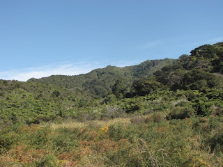
After Bark Bay, we headed inland for a bit, and found a nice view of ... whatever the mountains behind Nelson are called.


The vegetation around this part was quite Mediterranean again.


We next dropped down to Tonga Bay, which is almost impossibly picturesque -- probably the first really really jaw-dropping bay of the walk.


There's a campsite, named for the granite quarry that used to be here.


It was just a short up and down to Onetahuti Bay, which was quite busy with water taxi and kayakers coming and going. This is about the northern limit of where the kayak hire companies let people take kayaks, for reasons that became pretty clear on our taxi ride out of the park, by when the weather wasn't so great.


We'd planned to have lunch while we waited for the tide to go out enough for crossing the inlet. Maybe this cool shelter was built by people killing time for the same reason.


It was here where sandflies first started to get really annoying, and it wasn't too long before getting a bit wet seemed a better option than hanging around for any longer.


This crossing didn't really seem too scary -- signs were inconsistent about whether you should only cross within three or four hours of low tide, and we crossed about 3.5 hours before low tide and perhaps our knees got a little wet.


After an hour or so of mostly inland tramping we could see the famously posh Awaroa Lodge. It's so posh that it had a helipad, and indeed, a helicopter.


According to people we met at the hut later on, a couple staying at the lodge had decided that they wanted to have lunch in Motueka, so they just jumped in the 'copter and flew there, had lunch, and then flew back. As you do.

If helicoptering around is a bit too ordinary for you, there's also an airstrip.


The path dropped down to the coast and headed around into the highly tidal Awaroa inlet.


The tide was going out, so it looked pretty much as it would when we'd be crossing it the next morning. We never saw the inlet with the tide in, as it got dark before the water got very far in.

Not far along was the hut where we were staying for the night.


Awaroa hut is seriously plush.


Apart from the sandflies lurking in our dorm, that is.

The sub-hut where the DOC wardens stayed looked very nice; solar panels, a balcony and a mighty fine view.


As the sun disappeared beneath the mountains to the west of the hut, the sunset lit up the clouds in a pretty spectacular way that, as usual, was almost entirely impossible to capture on film.


The tide meant we needed to get a seriously early start the next day, but we still managed to stay up reading and chatting for an hour or so after it got dark -- meaning we went to bed at the very rock and roll time of 8:30pm!